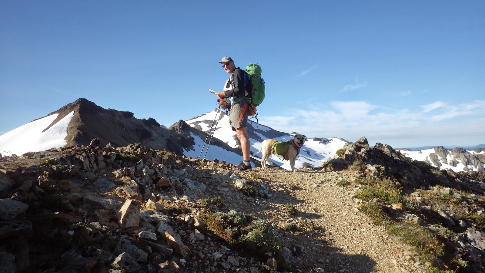
We hit the trail at 8 AM Saturday and flew down the Packwood Lake Trail and onto the Upper Lake Creek Trail. Not too long on the Upper Lake Creek Trail we noticed the trail getting worse. Eventually we crossed a deep creek on 3 sketchy 6" diameter logs and the followed cairns and pink tape through washed out areas.
 |
| Add caption |


The distance to Packwood Saddle using this route is supposed to be 11.4 miles using the map as a guide. The ascent from the basin to the saddle doesn't begin until after 12 miles and it steeply climbs. We stopped at a camp area along a creek just short of the saddle at 5300 feet. We had made 13.9 miles and 3357 feet of elevation by that point.


We set up camp, made water and hid inside the tent from the mosquito swarm that was ready to feast on us.


In the morning we got going early knowing that we were heading uphill for a while before we got a break. We hit the saddle quickly since we were only 200 feet below it and turned up Coyote Trail headed to Elk Pass and the PCT. The rise up from the saddle to Elk Pass is spectacular! The wildflowers were in bloom and the early light on the hills was perfect.


When we reached the PCT we headed up another hill to what is called "The Knife" on the PCT. We realized once we hit almost 7000 feet that the sign below was unclear and we had headed south, but the view from there was worth the extra effort. We headed back down and added an S and an N in ink on the PCT sign and headed north on the PCT.
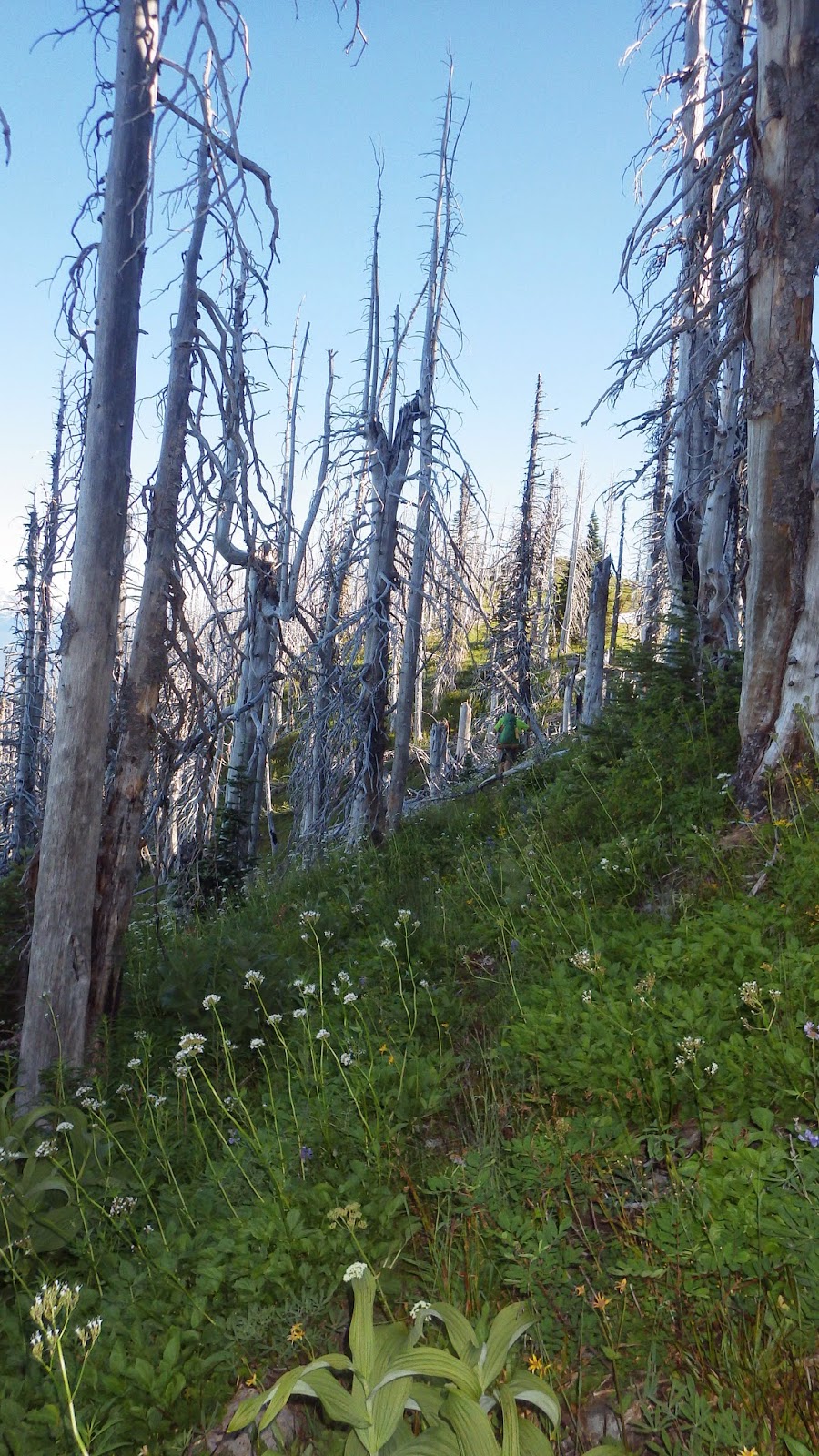
We had the usual early season issues to deal with including snow and blow downs and wash outs, but we kept a decent pace and descended to Tieton Pass Trail junction. The trees from McCall Basin to just below Hidden Springs Trail were bad. Some required extensive work arounds. We encountered a horseman who was cutting some of them just before the rise up to Hidden Springs. He asked about the trail and we gave him the sad news about another 20 or so trees to clear.
From that point we climbed up and up and up until we finally crossed the ridge above Shoe Lake.


The mosquitoes increased in logarithmic intensity as we descended towards some potential camp areas below, and we elected a forced march approach to HWY 12 and Leech Lake area instead.
We arrived at Leech Lake, made water and ate dinner before heading a little way up the PCT to a flat spot to set up camp. We ended up with 21.4 miles and 4344 feet of elevation gain for the day.
In the morning we decided to shortcut the route by heading down Hwy 12 to the Clear Lost Trail instead of hiking up to Sand Lake and back down.


In about 1 1/2 hours of walking we found the Clear Lost Trailhead and descended down 1 mile to the Cowlitz River. We were surprised to see no bridge or work around so we had to decide whether to turn around or ford the river. I found a sketchy log to straddle and get my pack across dry and then waded back to carry Athena across. It was below waist deep on me so Pam followed with her pack and we were across, but now where was the trail?
I switched the GPS to Map and bushwhacked in the direction of the trail with Athena and Pam behind and, voila, there it was! We kept a decent pace, but the mileage and mosquito bites from the day before were telling on all of us. We made Dewey's Cabin at the Clear Fork Trail Junction and had a bite to eat.


From that point you climb up from 3800 feet to 5200 at the Coyote Lake Trail junction, but our goal was Lost Hat Lake. We slogged on and did some descending before finally climbing back up to the lake at just under 5700 feet. We managed 11.52 miles and 2788 feet of elevation gain for our "easy" day.
We had Lost Hat Lake to ourselves, and since we arrived at just after noon, we had lots of time to hang out and recover. In the morning we had a 900 foot ascent to begin the day.


In the morning we ate and headed up the trail which was soon lost, but thanks to the Map section of the GPS we kept going the right direction across the snowfield until we saw the trail again just below where we climbed out to the Old Lookout Site.


The views were spectacular including all of the usual suspects - Rainier, Adams, St Helens and Hood. We took a break and then started down. It wasn't 40 steps before I lost my breakfast, nauseous from over 100 mosquito bites, a little heat exhaustion, minor dehydration and lack of sleep. We headed down to a trail juncture that was marked, but by a fallen over sign.
We took the way that looked correct on the Green Trails Map and headed down, ostensibly, to Lost Lake and the Packwood Lake and then the car. The trails up there were little more than an animal track and there was no additional signage. When we were overdue for finding Lost Lake we realized that we were instead on the Bluff Lake Trail. At that point turning around to hope to find the correct trail was a worse option than heading down and, worse case, walking the Forest Service Roads to HWY 12 to hitch a ride to Packwood and the find a local to drive us up to the trailhead so we kept heading down.
We were less than 1/2 mile below the trailhead at Bluff Lake Trail when we saw 2 young women walking their dog up towards us. Pam restrained Athena since she still acts like an idiot around other dogs and I approached the ladies. They said they were surprised to see anyone on the trail and we informed them that we had made a routing mistake and were making our way back t Packwood Lake Trailhead. They said that that was a long way away to which I agreed and laid out our plan.
They continued up as we walked down and soon we heard "Hold Up." We stopped and one of them who we later learned was Kelly offered to drive us to our car. She arranged a meet up time with her partner and we headed down to her truck and loaded up for the 26 mile ride to Packwood Lake Trailhead. Along the way we were pulled over by a State Trooper who let us go after hearing the story even though Kelly had left her wallet at their camp area and had no ID or a valid insurance card.
It turns out that our trail angels live maybe a mile from us. I gave them my number and made Kelly promise to call when they were back from vacation so we could buy them dinner. She said she would.
We arrived home around 2:30 and showered before heading up for some Italian food. We were asleep by 7:30. The entire trip was 57.11 miles and 11,690 feet of elevation gain. We were mostly alone for the entire trip in pristine wilderness with huge expansive views. We were lucky enough to make a mistake that led us to meet two people who renewed our faith in humanity by taking time out of their day to help strangers.
Be very well and more soon....