Sunday, October 27, 2013

Mount Rose = Relentless Grade

Saturday Pam Sue and I headed out to the Peninsula to hike up Mt. Rose. About 2 miles past Mt Rose you enter the Olympic National Park where you can hike Wagonwheel Lake. There is a sign there that warns you that it is the steepest trail in the park. They'd have to move that sign to Mt Rose trailhead if Mt Rose was in the park.


This trail gains 3700 feet in the 2.9 mile route to the summit and no mile of it has less than 1200 feet of elevation gain. She is a trudge that is always a great workout.

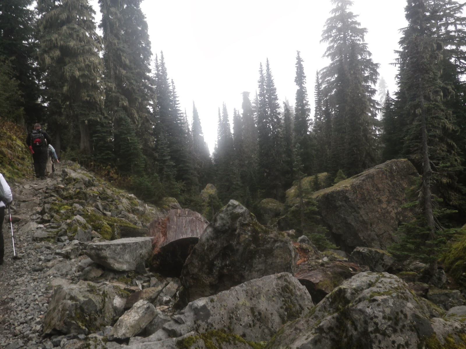
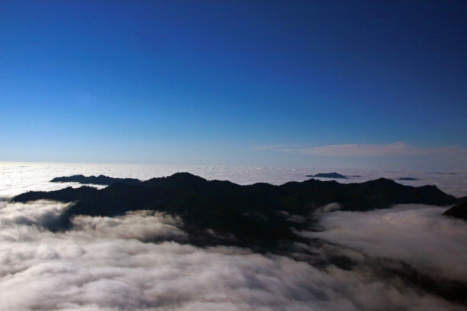
We were the only car at the trailhead at 8 AM and the trail was in great shape all the way up. It was foggy in the middle part of the trail until about Horse Camp at 3000 feet of elevation and then the sun was out. We made the summit in just over 2 hours and enjoyed a nice break with a couple of Common Jays that were game for any food we might have to spare.


We took the lollipop route down along the ridge back to Horse Camp and continued down - back in the fog again. With the lollipop, we weren't sure if there was anyone else on the trail until we ran into a couple less than a mile from the trailhead. At the trailhead we saw that there were 5 other cars.

One of our favorite parts of hiking the peninsula is lunch at El Puerto de Angeles IV in Hoodsport for beers and the shrimp fajitas. Even with lunch we were back home at 3.

Be very well and more soon....

Sunday, October 20, 2013

The Muir Snowfield - And Bluegrass

We had the weekend all planned out. We were going to watch a friend and her bluegrass band Friday night and then we would have all the time we needed to get up to Camp Muir on Saturday on what was predicted to be a cold but clear day.

You know what they say about the best laid plans. The band was actually playing on Saturday night so we had to have a turnaround time that would get us home showered and fed and in Gig Harbor in time for the show.

We arrived to find about 5 cars in the parking lot at Paradise - one of which was blasting some 1960 Era Soviet music from his rig as he packed up. We hit the trail at just after 8 and we quickly found some icy asphalt paths heading up out of Paradise. The snow was nice and crunchy which made for good walking though.


The first section was shaded and we made good time getting to the Panorama Point area where there were some dicey - icy - switchbacks to deal with before hiking out to the Muir Snowfield. There the sun was shining and we could tell that the return was going to be difficult with "juicy" snow and posthole opportunities. We steadily climbed up the snowfield to 9060 feet of altitude - completing 3600 of the 4600 feet of total elevation gain in the hike, but with about a mile and 1000 feet to go we knew we had reached our turn around point.


The start of the switchbacks by Panorama Point


Dave and Garry continued up following a skinning skier in a pink tutu for motivation while Pam and I headed down. We were only able to glissade one steep slope of any distance because the snow was wet and soft in the sun. The first couple of miles down the snow was mostly easy to walk with some post-holing, but after that it was a real workout with juicy snow more than knee deep that was messy to the point where snowshoes wouldn't have provided much help.

The last mile or so to Paradise we must have heard 8-10 foreign languages spoken by 20 or more groups. That is fairly normal on a sunny day up there, but it always reminds me what a great gift we have in our National Parks.

Be very well and more soon....

Tuesday, October 15, 2013

Kendall Katwalk - With A Little Snow Please

Despite a steady rain at home, we headed up Saturday to hike a section of the Pacific Crest Trail from Snoqualmie Pass area to Kendall Katwalk and back. Garmin says we covered 12.37 miles and got in 2922 feet of elevation gain.

The trail was in great shape although there are multiple terrains involved from dirt and gravel to some shale and granite so a good pair of boots is advisable. There are also several water crossings so trekking poles for balance are also a good idea. Pam led us up most of the way and it was about 1.5 miles from the Katwalk that we ran into our first snow of the fall. It was great walking snow so we didn't need to put our microspikes on.


We crossed paths with a large group that were turning around because of the snow as well as a lone hiker whose aim was to scramble Kendall Peak which is along the way. We arrived at the Katwalk and walked to the far side before returning to the other side for a snack before heading down.

Nature made art.


The Katwalk


The scramble route to Kendall Peak


When I first heard the name Katwalk I imagined a suspension bridge, but it is a granite area where they cut the trail out of the granite across a hog's back with steep drops on either side. The resulting trail has only steep drops on one side.

We headed back down and were only lightly rained on at the very bottom so it proved our premise that you should always go to the trailhead even when it's raining at home.

Be very well and more soon...